tóng-àn:China Fujian2 location map.svg

Choân kái-sek-tō͘ (SVG ùng-giông, chék-cháung: 780 × 818 chuông-só, ùng-giông duâi-nâung:277 KB)
|
|
Che sī tùi Wikimedia Commons ín--lâi ê chi̍t hūn tóng-àn. I tī hia ê kì-su̍t-ia̍h téng-bīn ê chu-sìn hián-sī ùi ē-té. |
Khài-iàu
| Soat-bêng |
Quadratische Plattkarte, N-S-Streckung 111 %. Geographische Begrenzung der Karte:
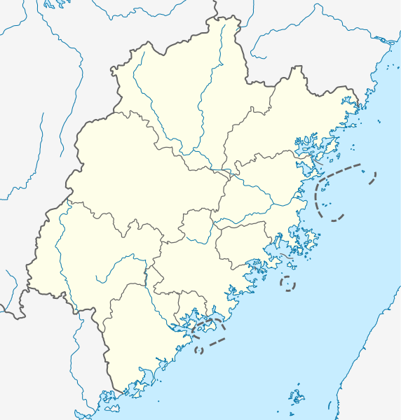
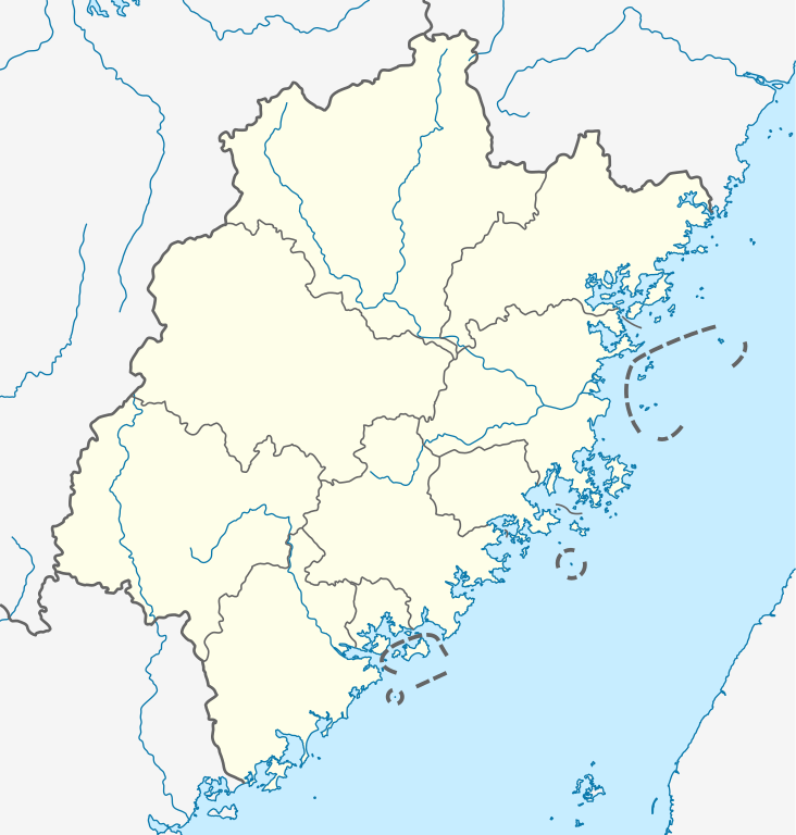
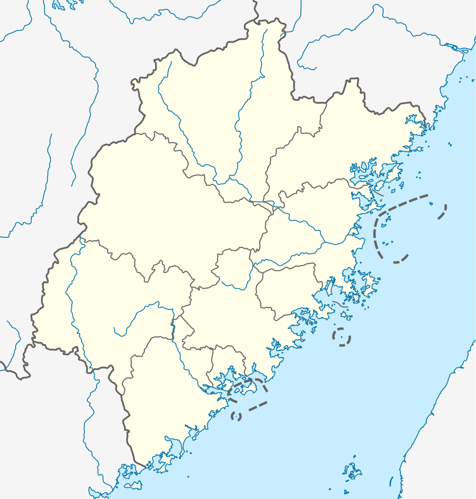
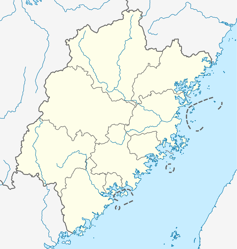
English: Location map of Fujian, People's Republic of China
(Note: the insular counties of Kinmen (Quemoy) and Lienchiang (Matsu Islands), Taiwan (ROC), are shown with dashed lines.) Equirectangular projection, N/S stretching 111 %. Geographic limits of the map:
|
|
| Ji̍t-kî | ||
| Chhut-chhù |
Ka-tī chò--ê, using
|
|
| Chok-chiá | NordNordWest | |
| 授權允准 (Bô siŏh-huòi sāi ciā ùng-giông) |
此檔案採用創用CC 姓名標示-相同方式分享 3.0 德國授權條款。
 此檔案採用創用CC 姓名標示-相同方式分享 3.0 未在地化版本授權條款。
|


|
|
Tóng-àn le̍k-sú
Chhi̍h ji̍t-kî/sî-kan, khoàⁿ hit sî-chūn--ê tóng-àn.
| Ji̍t-kî/Sî-kan | Sáuk-liŏk-dù | Chióh-cháung | Iōng-chiá | Chù-kái | |
|---|---|---|---|---|---|
| hiān-chāi | 2020-nî 10-goe̍h 14-ji̍t (pài-saⁿ) 17:21 | | 780 × 818(277 KB) | NordNordWest | upd |
| 2011-nî 6-goe̍h 20-ji̍t (pài-it) 12:18 |  | 780 × 818(282 KB) | NordNordWest | =={{int:filedesc}}== {{Information |Description= {{de|Positionskarte von Fujian, Volksrepublik China}} Quadratische Plattkarte, N-S-Streckung 111 %. Geographische Begrenzung der Karte: * N: 28.5° N * S: 23.3° N |
Iáⁿ-siōng liân-kiat
Í-hā ê ia̍h liân kàu chit ê iáⁿ-siōng:
tóng-àn hō͘ lâng sái--ê chōng-hóng
Ē-kha--ê kî-thaⁿ wiki ēng tio̍h chit--ê tóng-àn:
- ar.wikipedia.org hō͘ lâng ēng--ê chêng-hêng
- bg.wikipedia.org hō͘ lâng ēng--ê chêng-hêng
- bn.wikipedia.org hō͘ lâng ēng--ê chêng-hêng
- cdo.wikipedia.org hō͘ lâng ēng--ê chêng-hêng
- ceb.wikipedia.org hō͘ lâng ēng--ê chêng-hêng
- cs.wikipedia.org hō͘ lâng ēng--ê chêng-hêng
- en.wikipedia.org hō͘ lâng ēng--ê chêng-hêng
檢視此檔案的更多全域使用狀況。