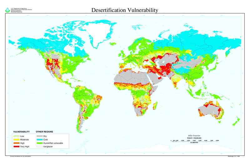
tóng-àn:Desertification map.png

Seng khoàⁿ chiàm-liōng: 800 × 518 siōng-sò͘. Kî-thaⁿ--ê kái-sek-tō͘: 320 × 207 siōng-sò͘ | 640 × 414 siōng-sò͘ | 1,024 × 663 siōng-sò͘ | 1,280 × 828 siōng-sò͘ | 2,560 × 1,656 siōng-sò͘ | 6,800 × 4,400 siōng-sò͘.
Choân kái-sek-tō͘ (6,800 × 4,400 siōng-sò͘ , tóng-àn chiàm-liōng: 1.04 MB, MIME luī-hêng: image/png)
Tóng-àn le̍k-sú
Chhi̍h ji̍t-kî/sî-kan, khoàⁿ hit sî-chūn--ê tóng-àn.
| Ji̍t-kî/Sî-kan | Sáuk-liŏk-dù | Chióh-cháung | Iōng-chiá | Chù-kái | |
|---|---|---|---|---|---|
| hiān-chāi | 2022-nî 3-goe̍h 27-ji̍t (lé-pài) 11:01 |  | 6,800 × 4,400(1.04 MB) | No.cilepogača | Reverted to version as of 00:12, 8 November 2006 (UTC) |
| 2006-nî 11-goe̍h 8-ji̍t (pài-saⁿ) 05:11 |  | 1,700 × 1,100(558 KB) | Paleorthid | {{Information |Description=Global Desertification Vulnerability Map |Source=http://soils.usda.gov/use/worldsoils/mapindex/desert-map.zip |Date=1998 |Author=USDA employee |Permission=This image is a work of a United States Department of Agriculture employe | |
| 2006-nî 11-goe̍h 8-ji̍t (pài-saⁿ) 00:12 |  | 6,800 × 4,400(1.04 MB) | Paleorthid | {{Information |Description=Global Desertification Vulnerability Map |Source=http://soils.usda.gov/use/worldsoils/mapindex/desert-map.zip |Date=1998 |Author=USDA employee |Permission=This image is a work of a United States Department of Agriculture employe |
Iáⁿ-siōng liân-kiat
Í-hā ê ia̍h liân kàu chit ê iáⁿ-siōng:
tóng-àn hō͘ lâng sái--ê chōng-hóng
Ē-kha--ê kî-thaⁿ wiki ēng tio̍h chit--ê tóng-àn:
- ar.wikipedia.org hō͘ lâng ēng--ê chêng-hêng
- az.wikipedia.org hō͘ lâng ēng--ê chêng-hêng
- bg.wikipedia.org hō͘ lâng ēng--ê chêng-hêng
- bn.wikipedia.org hō͘ lâng ēng--ê chêng-hêng
- bo.wikipedia.org hō͘ lâng ēng--ê chêng-hêng
- ca.wikinews.org hō͘ lâng ēng--ê chêng-hêng
- ckb.wikipedia.org hō͘ lâng ēng--ê chêng-hêng
- cs.wikipedia.org hō͘ lâng ēng--ê chêng-hêng
- da.wikipedia.org hō͘ lâng ēng--ê chêng-hêng
- de.wikipedia.org hō͘ lâng ēng--ê chêng-hêng
- de.wiktionary.org hō͘ lâng ēng--ê chêng-hêng
- el.wikipedia.org hō͘ lâng ēng--ê chêng-hêng
- en.wikipedia.org hō͘ lâng ēng--ê chêng-hêng
- eo.wikipedia.org hō͘ lâng ēng--ê chêng-hêng
- es.wikipedia.org hō͘ lâng ēng--ê chêng-hêng
- eu.wikipedia.org hō͘ lâng ēng--ê chêng-hêng
- fa.wikipedia.org hō͘ lâng ēng--ê chêng-hêng
- fi.wikipedia.org hō͘ lâng ēng--ê chêng-hêng
- fr.wikipedia.org hō͘ lâng ēng--ê chêng-hêng
- fr.wikinews.org hō͘ lâng ēng--ê chêng-hêng
- ga.wikipedia.org hō͘ lâng ēng--ê chêng-hêng
- he.wikipedia.org hō͘ lâng ēng--ê chêng-hêng
- hu.wikipedia.org hō͘ lâng ēng--ê chêng-hêng
- hy.wikipedia.org hō͘ lâng ēng--ê chêng-hêng
- id.wikipedia.org hō͘ lâng ēng--ê chêng-hêng
- is.wikipedia.org hō͘ lâng ēng--ê chêng-hêng
- it.wikipedia.org hō͘ lâng ēng--ê chêng-hêng
- ja.wikipedia.org hō͘ lâng ēng--ê chêng-hêng
檢視此檔案的更多全域使用狀況。
