tóng-àn:Island of Ireland location map Down.svg

此 SVG 檔案的 PNG 預覽的大小:796 × 599 siōng-sò͘。 Kî-thaⁿ--ê kái-sek-tō͘: 319 × 240 siōng-sò͘ | 638 × 480 siōng-sò͘ | 1,020 × 768 siōng-sò͘ | 1,280 × 964 siōng-sò͘ | 2,560 × 1,928 siōng-sò͘ | 931 × 701 siōng-sò͘.
Choân kái-sek-tō͘ (SVG ùng-giông, chék-cháung: 931 × 701 chuông-só, ùng-giông duâi-nâung:826 KB)
|
|
Che sī tùi Wikimedia Commons ín--lâi ê chi̍t hūn tóng-àn. I tī hia ê kì-su̍t-ia̍h téng-bīn ê chu-sìn hián-sī ùi ē-té. |
| Soat-bêng |
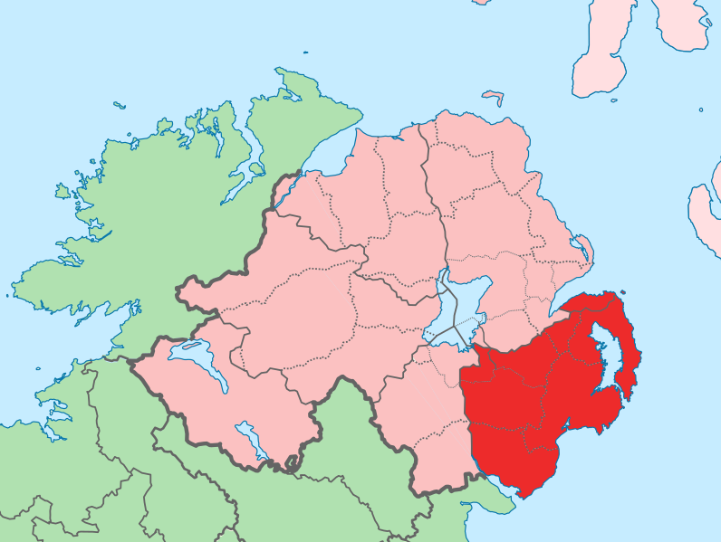
English: The island of Ireland, showing international border between Ireland and Northern Ireland, traditional provinces, traditional counties, and local authority areas in Ireland and Northern Ireland. |
| Ji̍t-kî | (UTC) |
| Chhut-chhù | |
| Chok-chiá |
|
| 這是一張修飾過的圖片,即本圖片是用軟體修改過後的版本,修改的方式或內容有:Added colours for specific county。原版圖片來源:Island of Ireland location map.svg。修改者:Mabuska。
|
我,本作品的著作權持有者,決定用以下授權條款發佈本作品:
此檔案採用創用CC 姓名標示-相同方式分享 3.0 未在地化版本授權條款。
- 你會使自由:
- 分享 – kho͘-pih, hoat-pò͘ kap thoân-pò͘ pún chok
- 重新修改 – kái-pian pún chok-phín
- Àn i-hā ê tiâu-kiāⁿ
- 標示名姓 – 您必須指名出正確的製作者,和提供授權條款的連結,以及表示是否有對內容上做出變更。您可以用任何合理的方式來行動,但不得以任何方式表明授權條款是對您許可或是由您所使用。
- 仝款方式方享 – Lí nā kái-tōng, piàn-khoán, he̍k-chiá kun-kù pún chok chhòng-chō, lí kaⁿ-taⁿ ē-tàng ēng kap pún chok kâng-khoán he̍k-chiá saⁿ-chhiūⁿ ê hí-khó lâi hoat-pò͘ chò--chhut-lâi ê chok-phín.
原始上傳日誌
This image is a derivative work of the following images:
- File:Island_of_Ireland_location_map.svg licensed with Cc-by-sa-3.0
- 2010-03-06T20:43:33Z Rannpháirtí anaithnid 1450x1807 (679207 Bytes) Fix incorrectly coloured isands.
- 2010-03-03T22:19:29Z Rannpháirtí anaithnid 1450x1807 (679744 Bytes) {{Information |Description={{de|Positionskarte von [[:de:Irland|Irland]]}} Quadratische Plattkarte, N-S-Streckung 170 %. Geographische Begrenzung der Karte: * N: 55.6° N * S: 51.2° N * W: 11.0° W * O: 5.0° W {{en|Location
Uploaded with derivativeFX
Tóng-àn le̍k-sú
Chhi̍h ji̍t-kî/sî-kan, khoàⁿ hit sî-chūn--ê tóng-àn.
| Ji̍t-kî/Sî-kan | Sáuk-liŏk-dù | Chióh-cháung | Iōng-chiá | Chù-kái | |
|---|---|---|---|---|---|
| hiān-chāi | 2010-nî 7-goe̍h 19-ji̍t (pài-it) 13:02 | | 931 × 701(826 KB) | Mabuska | fixed scotland boundary |
| 2010-nî 7-goe̍h 19-ji̍t (pài-it) 11:45 |  | 934 × 717(828 KB) | Mabuska | {{Information |Description={{en|The island of Ireland, showing international border between Northern Ireland and Republic of Ireland, traditional provinces, traditional counties, and local authority areas in the Republic of Ireland and Northern Ireland.}} |
Iáⁿ-siōng liân-kiat
Í-hā ê ia̍h liân kàu chit ê iáⁿ-siōng:
tóng-àn hō͘ lâng sái--ê chōng-hóng
Ē-kha--ê kî-thaⁿ wiki ēng tio̍h chit--ê tóng-àn:
- ar.wikipedia.org hō͘ lâng ēng--ê chêng-hêng
- ast.wikipedia.org hō͘ lâng ēng--ê chêng-hêng
- bg.wikipedia.org hō͘ lâng ēng--ê chêng-hêng
- ca.wikipedia.org hō͘ lâng ēng--ê chêng-hêng
- cs.wikipedia.org hō͘ lâng ēng--ê chêng-hêng
- de.wikipedia.org hō͘ lâng ēng--ê chêng-hêng
- en.wikipedia.org hō͘ lâng ēng--ê chêng-hêng
- eo.wikipedia.org hō͘ lâng ēng--ê chêng-hêng
- es.wikipedia.org hō͘ lâng ēng--ê chêng-hêng
- eu.wikipedia.org hō͘ lâng ēng--ê chêng-hêng
- Belfast
- Newry
- Lisburn
- Bangor (Ipar Irlanda)
- Downpatrick
- Lankide:Euskaldunaa
- Newtownards
- Banbridge
- Down konderria
- Txantiloi:Down konderriko udalerriak
- Lurganville
- Ballynahinch (Down konderria)
- Carryduff
- Comber
- Donaghadee
- Dromore (Down konderria)
- Dundonald
- Holywood
- Kilkeel
- Newcastle (Down konderria)
- Warrenpoint
- Annahilt
- Annalong
- Annsborough
- Ardglass
- Atticall
- Aughnacloy (Down konderria)
- Ballela
- Balloo (Down konderria)
- Ballybannan
- Ballybeen
- Ballydargan
- Ballygowan
- Ballyhalbert
- Ballyhay
- Ballyhornan
- Ballykinler
- Ballylesson
- Ballylough
- Ballymacmaine
檢視此檔案的更多全域使用狀況。