tóng-àn:Isles of Scilly UK location map.svg

此 SVG 檔案的 PNG 預覽的大小:677 × 600 siōng-sò͘。 Kî-thaⁿ--ê kái-sek-tō͘: 271 × 240 siōng-sò͘ | 542 × 480 siōng-sò͘ | 867 × 768 siōng-sò͘ | 1,156 × 1,024 siōng-sò͘ | 2,312 × 2,048 siōng-sò͘ | 1,340 × 1,187 siōng-sò͘.
Choân kái-sek-tō͘ (SVG ùng-giông, chék-cháung: 1,340 × 1,187 chuông-só, ùng-giông duâi-nâung:558 KB)
|
|
Che sī tùi Wikimedia Commons ín--lâi ê chi̍t hūn tóng-àn. I tī hia ê kì-su̍t-ia̍h téng-bīn ê chu-sìn hián-sī ùi ē-té. |
| Soat-bêng |
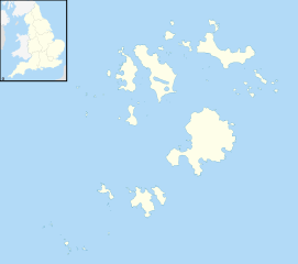
Blank map of the Isles of Scilly, UK with districts shown. Equirectangular map projection on WGS 84 datum, with N/S stretched 150% Geographic limits:
|
| Ji̍t-kî | |
| Chhut-chhù | Ordnance Survey OpenData. Most data from Boundary-Line product. Lake data from Meridian 2 product. Inset derived from England location map.svg by Spischot. |
| Chok-chiá | Nilfanion, created using Ordnance Survey data |
| 授權允准 (Bô siŏh-huòi sāi ciā ùng-giông) |
此檔案採用創用CC 姓名標示-相同方式分享 3.0 未在地化版本授權條款。 Biĕu-sê miàng-sáng: Contains Ordnance Survey data © Crown copyright and database right
|
Tóng-àn le̍k-sú
Chhi̍h ji̍t-kî/sî-kan, khoàⁿ hit sî-chūn--ê tóng-àn.
| Ji̍t-kî/Sî-kan | Sáuk-liŏk-dù | Chióh-cháung | Iōng-chiá | Chù-kái | |
|---|---|---|---|---|---|
| hiān-chāi | 2010-nî 9-goe̍h 26-ji̍t (lé-pài) 20:39 | | 1,340 × 1,187(558 KB) | Nilfanion | {{Information |Description=Blank map of the Isles of Scilly, UK with districts shown. Equirectangular map projection on WGS 84 datum, with N/S stretched 150% Geographic limits: *West: 6.45W *East: 6.23W *North: 49.99N *South: 49.86 |
Iáⁿ-siōng liân-kiat
Bô poàⁿ ia̍h liân kàu chit tiuⁿ iáⁿ-siōng.
tóng-àn hō͘ lâng sái--ê chōng-hóng
Ē-kha--ê kî-thaⁿ wiki ēng tio̍h chit--ê tóng-àn:
- af.wikipedia.org hō͘ lâng ēng--ê chêng-hêng
- ar.wikipedia.org hō͘ lâng ēng--ê chêng-hêng
- arz.wikipedia.org hō͘ lâng ēng--ê chêng-hêng
- ast.wikipedia.org hō͘ lâng ēng--ê chêng-hêng
- ca.wikipedia.org hō͘ lâng ēng--ê chêng-hêng
- ceb.wikipedia.org hō͘ lâng ēng--ê chêng-hêng
- de.wikipedia.org hō͘ lâng ēng--ê chêng-hêng
- Bishop Rock
- Samson (Insel)
- Annet (Scilly-Inseln)
- St Mary’s (Scilly-Inseln)
- St Mary’s Airport
- Tresco
- Hugh Town
- St. Martin’s
- Great Ganilly
- Teän
- St. Helen’s
- Zantman’s Rock
- Crim Rocks
- Round Island (Scilly-Inseln)
- Rosevear
- Bryher
- Gweal
- Gugh
- Vorlage:Positionskarte England Scilly-Inseln
- St. Agnes (Scilly-Inseln)
- White Island (Scilly-Inseln)
- Norrard Rocks
- Western Rocks (Scilly-Inseln)
- Eastern Isles
- Tresco Heliport
- el.wikipedia.org hō͘ lâng ēng--ê chêng-hêng
- en.wikipedia.org hō͘ lâng ēng--ê chêng-hêng
- Samson, Isles of Scilly
- Tresco, Isles of Scilly
- St Mary's, Isles of Scilly
- Hugh Town
- HMS Colossus (1787)
- Bant's Carn
- Porth Hellick Down
- Pednathise Head
- St Agnes, Isles of Scilly
- Bryher
- St Martin's, Isles of Scilly
- Zantman's Rock
- MV Cita
- Minnehaha (cargo ship)
- SS Thames
- Annet, Isles of Scilly
- Crim Rocks
檢視此檔案的更多全域使用狀況。