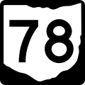
tóng-àn:OH-78.svg

此 SVG 檔案的 PNG 預覽的大小:600 × 600 siōng-sò͘。 Kî-thaⁿ--ê kái-sek-tō͘: 240 × 240 siōng-sò͘ | 480 × 480 siōng-sò͘ | 768 × 768 siōng-sò͘ | 1,024 × 1,024 siōng-sò͘ | 2,048 × 2,048 siōng-sò͘.
Choân kái-sek-tō͘ (SVG 檔案,表面大小:600 × 600 像素,檔案大小:6 KB)
Tóng-àn le̍k-sú
Chhi̍h ji̍t-kî/sî-kan, khoàⁿ hit sî-chūn--ê tóng-àn.
| Ji̍t-kî/Sî-kan | Suè-tiunn-tôo | Tshùn-tshioh | Iōng-chiá | Chù-kái | |
|---|---|---|---|---|---|
| hiān-chāi | 2012-nî 6-goe̍h 23-ji̍t (pài-la̍k) 21:03 |  | 600 × 600(6 KB) | Highway Route Marker Bot | Update per User:Highway Route Marker Bot/Requests#Ohio state route markers using File:Ohio 2d template.svg. |
| 2006-nî 8-goe̍h 19-ji̍t (pài-la̍k) 05:24 |  | 600 × 600(10 KB) | Homefryes | == Summary == {{Information |Description=600 mm by 600 mm (24 in by 24 in) Ohio State Route shield, made to the specifications existing photos found on [Dan Garnell’s http://www.state-ends.com/ohio/ Ohio Highway Ends]. Uses the [http://www.triskele.com/ |
Iáⁿ-siōng liân-kiat
Í-hā ê ia̍h liân kàu chit ê iáⁿ-siōng:
tóng-àn hō͘ lâng sái--ê chōng-hóng
Ē-kha--ê kî-thaⁿ wiki ēng tio̍h chit--ê tóng-àn:
- bn.wikipedia.org hō͘ lâng ēng--ê chêng-hêng
- en.wikipedia.org hō͘ lâng ēng--ê chêng-hêng
- Monroe County, Ohio
- Ohio State Route 821
- Ohio State Route 7
- List of highways numbered 78
- Ohio State Route 37
- List of state routes in Ohio
- Ohio State Route 13
- Ohio State Route 83
- Ohio State Route 26
- Ohio State Route 77
- Ohio State Route 78
- Ohio State Route 60
- Ohio State Route 79
- Ohio State Route 146
- Ohio State Route 800
- Interstate 77 in Ohio
- Ohio State Route 669
- Ohio State Route 691
- Ohio State Route 685
- Ohio State Route 555
- Ohio State Route 147
- Ohio State Route 377
- Ohio State Route 376
- Ohio State Route 216
- Ohio State Route 379
- Ohio State Route 145
- Ohio State Route 607
- Ohio State Route 260
- Ohio State Route 536
- Ohio State Route 564
- User:Oldiesmann/sandbox
- U.S. Route 33 in Ohio
- User:Cards84664/Freeway
- fr.wikipedia.org hō͘ lâng ēng--ê chêng-hêng
