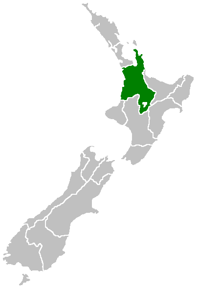
tóng-àn:Position of Waikato Region.png
Position_of_Waikato_Region.png (405 × 590 siōng-sò͘ , tóng-àn chiàm-liōng: 7 KB, MIME luī-hêng: image/png)
Tóng-àn le̍k-sú
Chhi̍h ji̍t-kî/sî-kan, khoàⁿ hit sî-chūn--ê tóng-àn.
| Ji̍t-kî/Sî-kan | Suè-tiunn-tôo | Tshùn-tshioh | Iōng-chiá | Chù-kái | |
|---|---|---|---|---|---|
| hiān-chāi | 2005-nî 4-goe̍h 27-ji̍t (pài-saⁿ) 07:41 |  | 405 × 590(7 KB) | Domie~commonswiki | Region of New Zealand, position on the map (source:English Wiki) {{PD}} Category:Maps of New Zealand |
Iáⁿ-siōng liân-kiat
Í-hā ê ia̍h liân kàu chit ê iáⁿ-siōng:
tóng-àn hō͘ lâng sái--ê chōng-hóng
Ē-kha--ê kî-thaⁿ wiki ēng tio̍h chit--ê tóng-àn:
- en.wikipedia.org hō͘ lâng ēng--ê chêng-hêng
- Mamaku Ranges
- Cape Colville
- Motukawao Islands
- Coromandel Range
- Slipper Island
- Lake Maraetai
- Lake Arapuni
- Lake Waikare
- Mangateparu
- Māhoenui
- Ōhakuri Dam
- Template:Waikato-geo-stub
- Huntly Power Station
- Lady Knox Geyser
- Horseshoe Lake (New Zealand)
- Lake Rotopounamu
- Awakino
- Kārewa / Gannet Island
- Waihi Village
- Hauauru ma raki
- Te Huka Power Station
- Portal:Monarchy
- Te Rapa cogeneration
- Te Mihi Power Station
- Wairakei Power Station
- Te Uku Wind Farm
- Aratiatia Power Station
- Ohaaki Power Station
- Poihipi Power Station
- Rotokawa Power Station
- Horahora Power Station
- Karāpiro Power Station
- Nga Awa Purua Power Station
- Madonna Falls
- Ben Lomond (Waikato)
- Tongariro Power Scheme
- Atiamuri Power Station
- Maraetai Power Station
- Arapuni Power Station
- Meremere Power Station
- Whakamaru Dam
- Wairere Falls
- Seabird Coast
- Ngatamariki Power Station
- Non-sovereign monarchy
- Whitianga Festival of Speed
- List of localities in Waikato
- Waikato County
- Hamilton Town Belt
- Grandview Heights, New Zealand
Khuànn tsit-ê tóng-àn ê koh-khah-tsuē tsuân-i̍k sú-iōng.

