tóng-àn:Dover UK locator map.svg

此 SVG 檔案的 PNG 預覽的大小:800 × 561 siōng-sò͘。 Kî-thaⁿ--ê kái-sek-tō͘: 320 × 225 siōng-sò͘ | 640 × 449 siōng-sò͘ | 1,024 × 719 siōng-sò͘ | 1,280 × 898 siōng-sò͘ | 2,560 × 1,796 siōng-sò͘ | 1,425 × 1,000 siōng-sò͘.
Choân kái-sek-tō͘ (SVG ùng-giông, chék-cháung: 1,425 × 1,000 chuông-só, ùng-giông duâi-nâung:1.18 MB)
|
|
Che sī tùi Wikimedia Commons ín--lâi ê chi̍t hūn tóng-àn. I tī hia ê kì-su̍t-ia̍h téng-bīn ê chu-sìn hián-sī ùi ē-té. |
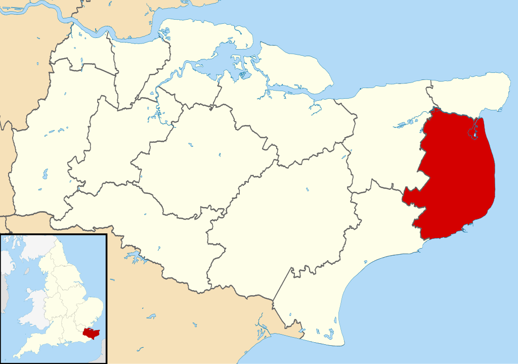
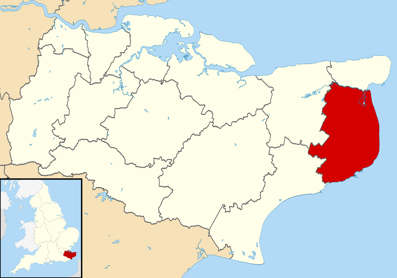
| Soat-bêng | Equirectangular map projection on WGS 84 datum, with N/S stretched 160% |
| Ji̍t-kî | |
| Chhut-chhù |
|
| Chok-chiá | Nilfanion, created using Ordnance Survey data |
| 授權允准 (Bô siŏh-huòi sāi ciā ùng-giông) |
此檔案採用創用CC 姓名標示-相同方式分享 3.0 未在地化版本授權條款。 Biĕu-sê miàng-sáng: Contains Ordnance Survey data © Crown copyright and database right
|
Tóng-àn le̍k-sú
Chhi̍h ji̍t-kî/sî-kan, khoàⁿ hit sî-chūn--ê tóng-àn.
| Ji̍t-kî/Sî-kan | 細張圖 | 寸尺 | Iōng-chiá | Chù-kái | |
|---|---|---|---|---|---|
| hiān-chāi | 2011-nî 8-goe̍h 2-ji̍t (pài-jī) 09:07 | | 1,425 × 1,000(1.18 MB) | Nilfanion | {{Information |Description=Map of Kent, UK with Dover highlighted. Equirectangular map projection on WGS 84 datum, with N/S stretched 160% |Source=Ordnance Survey [https://www.ordnancesurvey.co.uk/o |
Iáⁿ-siōng liân-kiat
Í-hā ê ia̍h liân kàu chit ê iáⁿ-siōng:
tóng-àn hō͘ lâng sái--ê chōng-hóng
Ē-kha--ê kî-thaⁿ wiki ēng tio̍h chit--ê tóng-àn:
- cy.wikipedia.org hō͘ lâng ēng--ê chêng-hêng
- en.wikipedia.org hō͘ lâng ēng--ê chêng-hêng
- Dover
- Sandwich, Kent
- Walmer
- Eythorne
- Dover District
- East Langdon
- Deal, Kent
- Eastry
- Drellingore
- Kingsdown, Dover
- Maxton, Kent
- Martin, Kent
- Martin Mill
- Coombe, Kent
- Ash, Dover District
- West Langdon
- Wingham, Kent
- Barfrestone
- Kearsney, Kent
- Elvington, Kent
- Capel-le-Ferne
- Richborough
- Lydden
- Whitfield, Kent
- Alkham
- Ripple, Kent
- Aylesham
- Nonington
- Marley, Dover
- Temple Ewell
- Preston-next-Wingham
- River, Kent
- Shepherdswell
- Plucks Gutter
- Template:Towns and villages in Dover district
- St Margaret's at Cliffe
- Sholden
- Tilmanstone
- Buckland, Kent
- Staple, Kent
- Great Mongeham
- User:O1ive/Dover
- Goodnestone, Dover
- Woodnesborough
- Guston, Kent
- Stourmouth
- Ashley, Kent
- Coldred
- Denton, Kent
檢視此檔案的更多全域使用狀況。