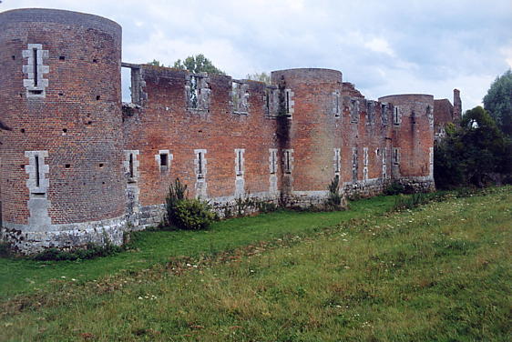
tóng-àn:Hallier courtine ouest Nibelle.jpg
Hallier_courtine_ouest_Nibelle.jpg (562 × 376 siōng-sò͘ , tóng-àn chiàm-liōng: 54 KB, MIME luī-hêng: image/jpeg)
Tóng-àn le̍k-sú
Chhi̍h ji̍t-kî/sî-kan, khoàⁿ hit sî-chūn--ê tóng-àn.
| Ji̍t-kî/Sî-kan | Suè-tiunn-tôo | Tshùn-tshioh | Iōng-chiá | Chù-kái | |
|---|---|---|---|---|---|
| hiān-chāi | 2009-nî 3-goe̍h 1-ji̍t (lé-pài) 16:18 |  | 562 × 376(54 KB) | Bzh-99 | {{Information |Description={{fr|1=Vue de la courtine occidentale du Château du Hallier, commune de Nibelle, Loiret, FRANCE}} |Source=travail personnel (own work) |Author=Bzh-99 |Date= |Permission= |other_versions= }} <!--{{ImageUpload|fu |
Iáⁿ-siōng liân-kiat
Í-hā ê ia̍h liân kàu chit ê iáⁿ-siōng:
tóng-àn hō͘ lâng sái--ê chōng-hóng
Ē-kha--ê kî-thaⁿ wiki ēng tio̍h chit--ê tóng-àn:
- ca.wikipedia.org hō͘ lâng ēng--ê chêng-hêng
- ceb.wikipedia.org hō͘ lâng ēng--ê chêng-hêng
- ce.wikipedia.org hō͘ lâng ēng--ê chêng-hêng
- de.wikipedia.org hō͘ lâng ēng--ê chêng-hêng
- en.wikipedia.org hō͘ lâng ēng--ê chêng-hêng
- eo.wikipedia.org hō͘ lâng ēng--ê chêng-hêng
- es.wikipedia.org hō͘ lâng ēng--ê chêng-hêng
- eu.wikipedia.org hō͘ lâng ēng--ê chêng-hêng
- fr.wikipedia.org hō͘ lâng ēng--ê chêng-hêng
- hu.wikipedia.org hō͘ lâng ēng--ê chêng-hêng
- it.wikipedia.org hō͘ lâng ēng--ê chêng-hêng
- ku.wikipedia.org hō͘ lâng ēng--ê chêng-hêng
- lld.wikipedia.org hō͘ lâng ēng--ê chêng-hêng
- pl.wikipedia.org hō͘ lâng ēng--ê chêng-hêng
- pt.wikipedia.org hō͘ lâng ēng--ê chêng-hêng
- ro.wikipedia.org hō͘ lâng ēng--ê chêng-hêng
- sk.wikipedia.org hō͘ lâng ēng--ê chêng-hêng
- sv.wikipedia.org hō͘ lâng ēng--ê chêng-hêng
- tt.wikipedia.org hō͘ lâng ēng--ê chêng-hêng
- uk.wikipedia.org hō͘ lâng ēng--ê chêng-hêng
- uz.wikipedia.org hō͘ lâng ēng--ê chêng-hêng
- vec.wikipedia.org hō͘ lâng ēng--ê chêng-hêng
- www.wikidata.org hō͘ lâng ēng--ê chêng-hêng
- zh.wikipedia.org hō͘ lâng ēng--ê chêng-hêng


