tóng-àn:India satellite image.png

Seng khoàⁿ chiàm-liōng: 800 × 592 siōng-sò͘. Kî-thaⁿ--ê kái-sek-tō͘: 320 × 237 siōng-sò͘ | 640 × 474 siōng-sò͘ | 1,024 × 758 siōng-sò͘ | 1,278 × 946 siōng-sò͘.
Choân kái-sek-tō͘ (1,278 × 946 siōng-sò͘ , tóng-àn chiàm-liōng: 1.51 MB, MIME luī-hêng: image/png)
|
|
Che sī tùi Wikimedia Commons ín--lâi ê chi̍t hūn tóng-àn. I tī hia ê kì-su̍t-ia̍h téng-bīn ê chu-sìn hián-sī ùi ē-té. |
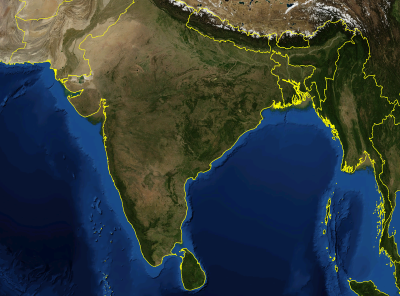
| Soat-bêng | Satellite image of India and surrounding regions | |||
| Ji̍t-kî | ||||
| Chhut-chhù | Ka-tī chò--ê | |||
| Chok-chiá | Mgiganteus | |||
| 授權允准 (Bô siŏh-huòi sāi ciā ùng-giông) |
|

| Annotations | This image is annotated: View the annotations at Commons |
Tóng-àn le̍k-sú
Chhi̍h ji̍t-kî/sî-kan, khoàⁿ hit sî-chūn--ê tóng-àn.
| Ji̍t-kî/Sî-kan | 細張圖 | 寸尺 | Iōng-chiá | Chù-kái | |
|---|---|---|---|---|---|
| hiān-chāi | 2007-nî 11-goe̍h 28-ji̍t (pài-saⁿ) 14:21 | | 1,278 × 946(1.51 MB) | Mgiganteus | {{Information |Description=Satellite image of India and surrounding regions |Source=self-made |Date=2007 |Author= Mgiganteus |Permission={{PD-WorldWind}} |other_versions= }} Category:Maps of India Category:South Asia [[Categor |
Iáⁿ-siōng liân-kiat
Í-hā ê ia̍h liân kàu chit ê iáⁿ-siōng:
tóng-àn hō͘ lâng sái--ê chōng-hóng
Ē-kha--ê kî-thaⁿ wiki ēng tio̍h chit--ê tóng-àn:
- af.wikipedia.org hō͘ lâng ēng--ê chêng-hêng
- ar.wikipedia.org hō͘ lâng ēng--ê chêng-hêng
- ast.wikipedia.org hō͘ lâng ēng--ê chêng-hêng
- ba.wikipedia.org hō͘ lâng ēng--ê chêng-hêng
- be-tarask.wikipedia.org hō͘ lâng ēng--ê chêng-hêng
- ca.wikipedia.org hō͘ lâng ēng--ê chêng-hêng
- cy.wikipedia.org hō͘ lâng ēng--ê chêng-hêng
- diq.wikipedia.org hō͘ lâng ēng--ê chêng-hêng
- en.wikipedia.org hō͘ lâng ēng--ê chêng-hêng
- 1932 in India
- 1822 in India
- 1934 in India
- 1937 in India
- 1870 in India
- 1946 in India
- 1911 in India
- 1939 in India
- 1945 in India
- 1943 in India
- 1931 in India
- 1941 in India
- 1857 in India
- 1906 in India
- 1944 in India
- 1930 in India
- 1889 in India
- 1942 in India
- 1874 in India
- 1922 in India
- 1936 in India
- 1905 in India
- 1940 in India
- 1935 in India
- 1921 in India
- 1885 in India
- 1869 in India
- 1875 in India
- 1938 in India
- 1853 in India
- 1818 in India
- 1877 in India
- 1919 in India
- 1861 in India
- 1923 in India
- 1924 in India
- 1925 in India
- 1907 in India
- User talk:Attenboroughii
- 1876 in India
- 1917 in India
- 1914 in India
檢視此檔案的更多全域使用狀況。