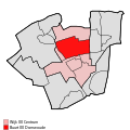
tóng-àn:Map - NL - Dantumadeel - Wijk 00 Centrum - Buurt 00 Damwoude.svg

此 SVG 檔案的 PNG 預覽的大小:375 × 375 siōng-sò͘。 Kî-thaⁿ--ê kái-sek-tō͘: 240 × 240 siōng-sò͘ | 480 × 480 siōng-sò͘ | 768 × 768 siōng-sò͘ | 1,024 × 1,024 siōng-sò͘ | 2,048 × 2,048 siōng-sò͘.
Choân kái-sek-tō͘ (SVG 檔案,表面大小:375 × 375 像素,檔案大小:23 KB)
Tóng-àn le̍k-sú
Chhi̍h ji̍t-kî/sî-kan, khoàⁿ hit sî-chūn--ê tóng-àn.
| Ji̍t-kî/Sî-kan | Suè-tiunn-tôo | Tshùn-tshioh | Iōng-chiá | Chù-kái | |
|---|---|---|---|---|---|
| hiān-chāi | 2009-nî 4-goe̍h 18-ji̍t (pài-la̍k) 22:07 |  | 375 × 375(23 KB) | Michiel1972 | {{Information |Description=<!--correct utf8, ALSO show buurt boundaries outside the "wijk" of the shown "buurt" --> |Source=own work, using free avaliable sources |Date= |Author=Michiel1972, {{Attribution|nolink=[http://www.cbs.nl Centraal Bureau voor de |
| 2009-nî 4-goe̍h 18-ji̍t (pài-la̍k) 18:49 |  | 375 × 375(16 KB) | Michiel1972 | {{Information |Description=<!--correct utf8, corrected /removed buurt boundaries outside the "wijk" of the shown "buurt" --> |Source=own work, using free avaliable sources |Date= |Author=Michiel1972, {{Attribution|nolink=[http://www.cbs.nl Centraal Burea | |
| 2009-nî 3-goe̍h 19-ji̍t (pài-sì) 21:01 |  | 375 × 375(16 KB) | Michiel1972 | {{Information |Description=*{{subst:PAGENAME}} *locator map showing municipality boundary (2009) and statistical district/neighbourhood boundaries according to CBS *Numbering and names of neighboorhoods as defined by CBS in the 2008 Esri publication brt_2 |
Iáⁿ-siōng liân-kiat
Í-hā ê ia̍h liân kàu chit ê iáⁿ-siōng:
tóng-àn hō͘ lâng sái--ê chōng-hóng
Ē-kha--ê kî-thaⁿ wiki ēng tio̍h chit--ê tóng-àn:
- ar.wikipedia.org hō͘ lâng ēng--ê chêng-hêng
- arz.wikipedia.org hō͘ lâng ēng--ê chêng-hêng
- ceb.wikipedia.org hō͘ lâng ēng--ê chêng-hêng
- nl.wikipedia.org hō͘ lâng ēng--ê chêng-hêng
- www.wikidata.org hō͘ lâng ēng--ê chêng-hêng
