tóng-àn:Stroud UK locator map.svg

此 SVG 檔案的 PNG 預覽的大小:516 × 600 siōng-sò͘。 Kî-thaⁿ--ê kái-sek-tō͘: 206 × 240 siōng-sò͘ | 413 × 480 siōng-sò͘ | 661 × 768 siōng-sò͘ | 881 × 1,024 siōng-sò͘ | 1,762 × 2,048 siōng-sò͘ | 1,089 × 1,266 siōng-sò͘.
Choân kái-sek-tō͘ (SVG ùng-giông, chék-cháung: 1,089 × 1,266 chuông-só, ùng-giông duâi-nâung:1.09 MB)
|
|
Che sī tùi Wikimedia Commons ín--lâi ê chi̍t hūn tóng-àn. I tī hia ê kì-su̍t-ia̍h téng-bīn ê chu-sìn hián-sī ùi ē-té. |
| Soat-bêng |
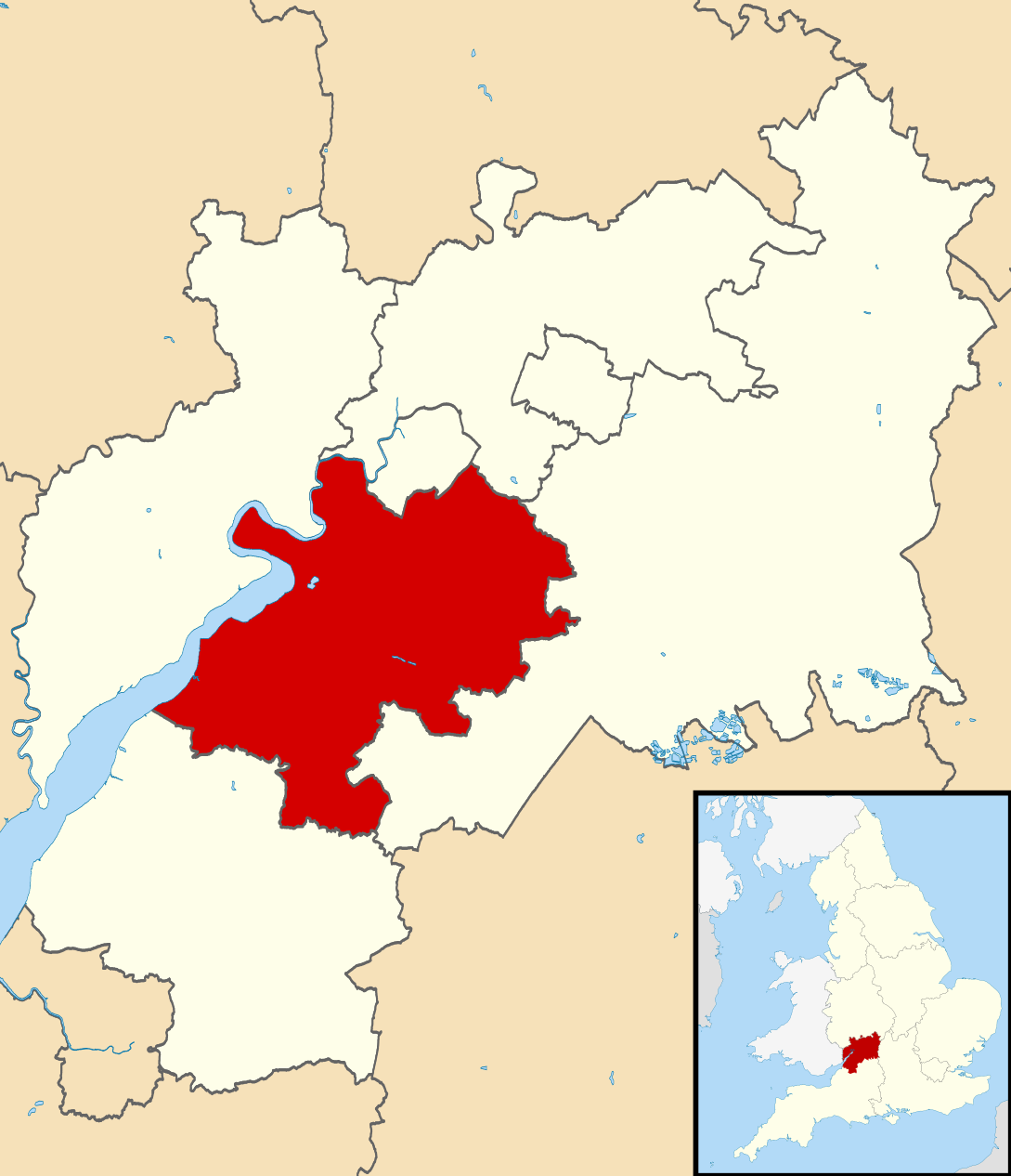
Map of Gloucestershire, UK with Stroud District highlighted. Equirectangular map projection on WGS 84 datum, with N/S stretched 160% |
| Ji̍t-kî | |
| Chhut-chhù |
|
| Chok-chiá | Nilfanion, created using Ordnance Survey data |
| 授權允准 (Bô siŏh-huòi sāi ciā ùng-giông) |
此檔案採用創用CC 姓名標示-相同方式分享 3.0 未在地化版本授權條款。 Biĕu-sê miàng-sáng: Contains Ordnance Survey data © Crown copyright and database right
|
Tóng-àn le̍k-sú
Chhi̍h ji̍t-kî/sî-kan, khoàⁿ hit sî-chūn--ê tóng-àn.
| Ji̍t-kî/Sî-kan | 細張圖 | 寸尺 | Iōng-chiá | Chù-kái | |
|---|---|---|---|---|---|
| hiān-chāi | 2011-nî 2-goe̍h 27-ji̍t (lé-pài) 12:29 | | 1,089 × 1,266(1.09 MB) | Nilfanion | {{Information |Description=Map of Gloucestershire, UK with Stroud District highlighted. Equirectangular map projection on WGS 84 datum, with N/S stretched 160% |Source=Ordnance Survey [h |
Iáⁿ-siōng liân-kiat
Í-hā ê ia̍h liân kàu chit ê iáⁿ-siōng:
tóng-àn hō͘ lâng sái--ê chōng-hóng
Ē-kha--ê kî-thaⁿ wiki ēng tio̍h chit--ê tóng-àn:
- bg.wikipedia.org hō͘ lâng ēng--ê chêng-hêng
- cy.wikipedia.org hō͘ lâng ēng--ê chêng-hêng
- en.wikipedia.org hō͘ lâng ēng--ê chêng-hêng
- fr.wikipedia.org hō͘ lâng ēng--ê chêng-hêng
- Dursley
- Stroud
- Stroud (district)
- Nailsworth
- Painswick
- Stonehouse (Gloucestershire)
- Wotton-under-Edge
- Randwick (Gloucestershire)
- Liste des paroisses civiles du Gloucestershire
- Cam (Royaume-Uni)
- Modèle:Palette Stroud
- Alderley (Gloucestershire)
- Alkington (Gloucestershire)
- Arlingham
- Woodchester
- Whitminster
- Upton St Leonards
- Uley
- Stinchcombe
- Standish (Gloucestershire)
- Slimbridge
- Rodborough
- Pitchcombe
- Owlpen
- Nympsfield
- North Nibley
- Moreton Valence
- Miserden
- Minchinhampton
- Lypiatt
- Leonard Stanley
- Kingswood (Stroud)
- King's Stanley
- Horsley (Gloucestershire)
- Hinton (Stroud)
- Hillesley and Tresham
- Haresfield
- Harescombe
- Hardwicke (Stroud)
- Hamfallow
- Ham and Stone
- Frocester
- Fretherne with Saul
- Frampton on Severn
- Elmore (Gloucestershire)
- Eastington (Stroud)
檢視此檔案的更多全域使用狀況。