tóng-àn:Thedford, Nebraska.jpg
Seng khoàⁿ chiàm-liōng: 800 × 533 siōng-sò͘. Kî-thaⁿ--ê kái-sek-tō͘: 320 × 213 siōng-sò͘ | 640 × 427 siōng-sò͘ | 1,024 × 683 siōng-sò͘ | 1,280 × 853 siōng-sò͘ | 2,560 × 1,707 siōng-sò͘ | 3,504 × 2,336 siōng-sò͘.
Choân kái-sek-tō͘ (3,504 × 2,336 siōng-sò͘ , tóng-àn chiàm-liōng: 6.71 MB, MIME luī-hêng: image/jpeg)
|
|
Che sī tùi Wikimedia Commons ín--lâi ê chi̍t hūn tóng-àn. I tī hia ê kì-su̍t-ia̍h téng-bīn ê chu-sìn hián-sī ùi ē-té. |
Khài-iàu
| Soat-bêng |
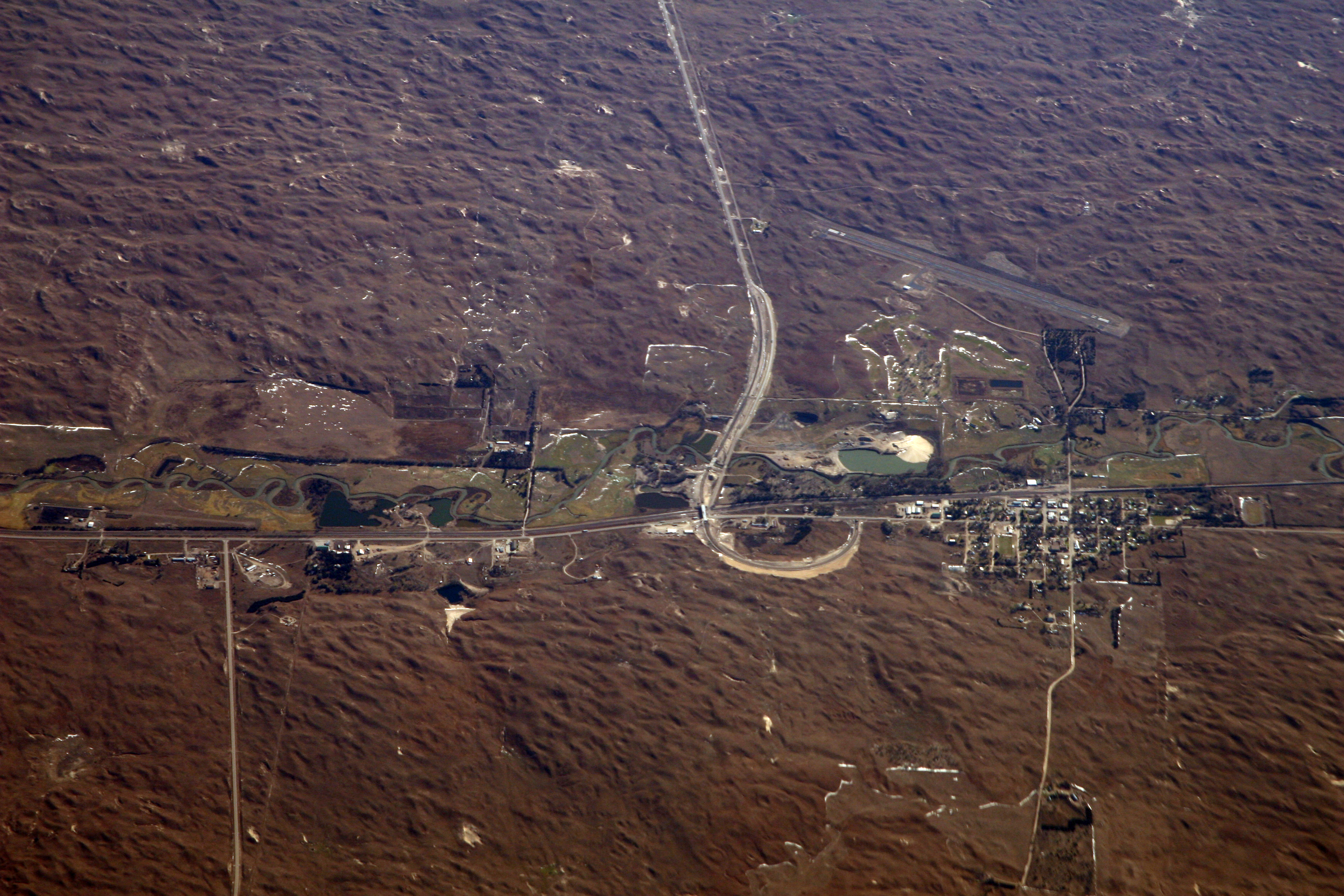
English: Thedford, Nebraska, in the midst of Nebraska's vast sand hills country. Nearest town to the Nebraska National Forest (far upper left corner), an anomalous patch of dark evergreen furrows on the sandhills of Nebraska. Says Wikipedia, "It was established in 1902 by Charles E. Bessey as an experiment to see if forests could be created in treeless areas of the Great Plains for use as a national timber reserve. This effort resulted in a 20,000-acre (80.9 km²) forest, the largest human-planted forest in the United States." From the air it is the most remarkable feature in the region. |
| Ji̍t-kî | |
| Chhut-chhù |
|
| Chok-chiá | Doc Searls from Santa Barbara, USA |
| 目標地點 | | 位於此地的本圖片與其他圖片: OpenStreetMap |
|---|
| Open this image as an overlay in Google Earth (Google Maps, Bing) | (Help|Source) |
Siū-khoân
此檔案採用創用CC 姓名標示-相同方式分享 2.0 通用版授權條款。
- 你會使自由:
- 分享 – kho͘-pih, hoat-pò͘ kap thoân-pò͘ pún chok
- 重新修改 – kái-pian pún chok-phín
- Àn i-hā ê tiâu-kiāⁿ
- 標示名姓 – 您必須指名出正確的製作者,和提供授權條款的連結,以及表示是否有對內容上做出變更。您可以用任何合理的方式來行動,但不得以任何方式表明授權條款是對您許可或是由您所使用。
- 仝款方式方享 – Lí nā kái-tōng, piàn-khoán, he̍k-chiá kun-kù pún chok chhòng-chō, lí kaⁿ-taⁿ ē-tàng ēng kap pún chok kâng-khoán he̍k-chiá saⁿ-chhiūⁿ ê hí-khó lâi hoat-pò͘ chò--chhut-lâi ê chok-phín.
| This image, originally posted to Flickr, was reviewed on January 22, 2010 by the administrator or reviewer File Upload Bot (Magnus Manske), who confirmed that it was available on Flickr under the stated license on that date. |
| Annotations | This image is annotated: View the annotations at Commons |
Tóng-àn le̍k-sú
Chhi̍h ji̍t-kî/sî-kan, khoàⁿ hit sî-chūn--ê tóng-àn.
| Ji̍t-kî/Sî-kan | 細張圖 | 寸尺 | Iōng-chiá | Chù-kái | |
|---|---|---|---|---|---|
| hiān-chāi | 2010-nî 1-goe̍h 22-ji̍t (pài-gō·) 21:31 | | 3,504 × 2,336(6.71 MB) | File Upload Bot (Magnus Manske) | {{Information |Description=Thedford, Nebraska, in the midst of Nebraska's vast sand hills country. Nearest town to the [http://en.wikipedia.org/wiki/Nebraska_National_Forest Nebraska National Forest], an anomalous patch of dark evergreen furrows on the [h |
Iáⁿ-siōng liân-kiat
Í-hā ê ia̍h liân kàu chit ê iáⁿ-siōng:
tóng-àn hō͘ lâng sái--ê chōng-hóng
Ē-kha--ê kî-thaⁿ wiki ēng tio̍h chit--ê tóng-àn:
- ar.wikipedia.org hō͘ lâng ēng--ê chêng-hêng
- azb.wikipedia.org hō͘ lâng ēng--ê chêng-hêng
- ca.wikipedia.org hō͘ lâng ēng--ê chêng-hêng
- ceb.wikipedia.org hō͘ lâng ēng--ê chêng-hêng
- en.wikipedia.org hō͘ lâng ēng--ê chêng-hêng
- es.wikipedia.org hō͘ lâng ēng--ê chêng-hêng
- eu.wikipedia.org hō͘ lâng ēng--ê chêng-hêng
- fa.wikipedia.org hō͘ lâng ēng--ê chêng-hêng
- fr.wikipedia.org hō͘ lâng ēng--ê chêng-hêng
- ht.wikipedia.org hō͘ lâng ēng--ê chêng-hêng
- hu.wikipedia.org hō͘ lâng ēng--ê chêng-hêng
- it.wikipedia.org hō͘ lâng ēng--ê chêng-hêng
- ky.wikipedia.org hō͘ lâng ēng--ê chêng-hêng
- lld.wikipedia.org hō͘ lâng ēng--ê chêng-hêng
- pl.wikipedia.org hō͘ lâng ēng--ê chêng-hêng
- pt.wikipedia.org hō͘ lâng ēng--ê chêng-hêng
- sr.wikipedia.org hō͘ lâng ēng--ê chêng-hêng
- sv.wikipedia.org hō͘ lâng ēng--ê chêng-hêng
- uk.wikipedia.org hō͘ lâng ēng--ê chêng-hêng
- www.wikidata.org hō͘ lâng ēng--ê chêng-hêng
- zh.wikipedia.org hō͘ lâng ēng--ê chêng-hêng