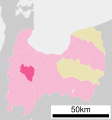
tóng-àn:Tonami in Toyama Prefecture Ja.svg

此 SVG 檔案的 PNG 預覽的大小:560 × 600 siōng-sò͘。 Kî-thaⁿ--ê kái-sek-tō͘: 224 × 240 siōng-sò͘ | 448 × 480 siōng-sò͘ | 717 × 768 siōng-sò͘ | 956 × 1,024 siōng-sò͘ | 1,911 × 2,048 siōng-sò͘.
Choân kái-sek-tō͘ (SVG 檔案,表面大小:560 × 600 像素,檔案大小:17 KB)
Tóng-àn le̍k-sú
Chhi̍h ji̍t-kî/sî-kan, khoàⁿ hit sî-chūn--ê tóng-àn.
| Ji̍t-kî/Sî-kan | Suè-tiunn-tôo | Tshùn-tshioh | Iōng-chiá | Chù-kái | |
|---|---|---|---|---|---|
| hiān-chāi | 2020-nî 10-goe̍h 31-ji̍t (pài-la̍k) 18:06 |  | 560 × 600(17 KB) | レオタード3世 | c:File:Tonami in Toyama Prefecture Ja.svgの11:52, 21 October 2020の版よりインポート(作成者:AichiWikiFixer) |
| 2020-nî 10-goe̍h 21-ji̍t (pài-saⁿ) 11:52 |  | 560 × 600(17 KB) | AichiWikiFixer | Updated as File:Map_of_Toyama_Prefecture_Ja.svg | |
| 2008-nî 11-goe̍h 12-ji̍t (pài-saⁿ) 19:21 |  | 560 × 692(9 KB) | Krisgrotius | {{Information| |Description= Location of Tonami in Toyama Prefecture |Source= Japanese wiki [http://ja.wikipedia.org/wiki/%E7%94%BB%E5%83%8F:%E5%9F%BA%E7%A4%8E%E8%87%AA%E6%B2%BB%E4%BD%93%E4%BD%8D%E7%BD%AE%E5%9B%B3_16208.svg] |Date=~~~~~ |Author=[[:ja | |
| 2007-nî 10-goe̍h 2-ji̍t (pài-jī) 12:18 |  | 560 × 692(9 KB) | Lincun | {{基礎自治体位置図画像情報|富山県|砺波市}} |
Iáⁿ-siōng liân-kiat
Í-hā ê ia̍h liân kàu chit ê iáⁿ-siōng:
tóng-àn hō͘ lâng sái--ê chōng-hóng
Ē-kha--ê kî-thaⁿ wiki ēng tio̍h chit--ê tóng-àn:
- azb.wikipedia.org hō͘ lâng ēng--ê chêng-hêng
- de.wikipedia.org hō͘ lâng ēng--ê chêng-hêng
- en.wikipedia.org hō͘ lâng ēng--ê chêng-hêng
- fa.wikipedia.org hō͘ lâng ēng--ê chêng-hêng
- fi.wikipedia.org hō͘ lâng ēng--ê chêng-hêng
- id.wikipedia.org hō͘ lâng ēng--ê chêng-hêng
- ja.wikipedia.org hō͘ lâng ēng--ê chêng-hêng
- ko.wikipedia.org hō͘ lâng ēng--ê chêng-hêng
- ms.wikipedia.org hō͘ lâng ēng--ê chêng-hêng
- nl.wikipedia.org hō͘ lâng ēng--ê chêng-hêng
- simple.wikipedia.org hō͘ lâng ēng--ê chêng-hêng
- sv.wikipedia.org hō͘ lâng ēng--ê chêng-hêng
- tg.wikipedia.org hō͘ lâng ēng--ê chêng-hêng
- uk.wikipedia.org hō͘ lâng ēng--ê chêng-hêng
- zh.wikipedia.org hō͘ lâng ēng--ê chêng-hêng

