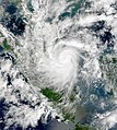
tóng-àn:Vamei 2001-12-27 0123Z.jpg

Seng khoàⁿ chiàm-liōng: 537 × 599 siōng-sò͘. Kî-thaⁿ--ê kái-sek-tō͘: 215 × 240 siōng-sò͘ | 430 × 480 siōng-sò͘ | 688 × 768 siōng-sò͘ | 918 × 1,024 siōng-sò͘ | 1,835 × 2,048 siōng-sò͘ | 5,998 × 6,693 siōng-sò͘.
Choân kái-sek-tō͘ (5,998 × 6,693 siōng-sò͘ , tóng-àn chiàm-liōng: 27.01 MB, MIME luī-hêng: image/jpeg)
Tóng-àn le̍k-sú
Chhi̍h ji̍t-kî/sî-kan, khoàⁿ hit sî-chūn--ê tóng-àn.
| Ji̍t-kî/Sî-kan | Suè-tiunn-tôo | Tshùn-tshioh | Iōng-chiá | Chù-kái | |
|---|---|---|---|---|---|
| hiān-chāi | 2013-nî 3-goe̍h 3-ji̍t (lé-pài) 20:34 |  | 5,998 × 6,693(27.01 MB) | Supportstorm | 250m resolution |
| 2012-nî 10-goe̍h 12-ji̍t (pài-gō·) 01:52 |  | 1,811 × 1,651(2.15 MB) | Supportstorm | Geo-Corrected/ removed lines and boarders | |
| 2006-nî 9-goe̍h 3-ji̍t (lé-pài) 17:32 |  | 1,268 × 1,024(393 KB) | Good kitty | == Summary == {{Information |Description=This image of Typhoon Vamei was acquired by the Moderate Resolution Imaging Spectroradiometer (MODIS) on the Terra satellite at 0335 UTC on December 27, 2001. Maximum sustained wind speeds were recorded at 75 knots |
Iáⁿ-siōng liân-kiat
Í-hā ê ia̍h liân kàu chit ê iáⁿ-siōng:
tóng-àn hō͘ lâng sái--ê chōng-hóng
Ē-kha--ê kî-thaⁿ wiki ēng tio̍h chit--ê tóng-àn:
- bn.wikipedia.org hō͘ lâng ēng--ê chêng-hêng
- en.wikipedia.org hō͘ lâng ēng--ê chêng-hêng
- Portal:Singapore/Selected article
- 2001 Pacific typhoon season
- Tropical Storm Vamei
- Portal:Tropical cyclones/Featured article/2006-Tropical Storm Vamei
- Portal:Singapore/Selected article/9
- User:TheDJ/sandbox
- List of tropical cyclones near the Equator
- Wikipedia:Today's featured article/December 2016
- Wikipedia:Today's featured article/December 26, 2016
- Wikipedia:Main Page history/2016 December 26
- User:Tfmbty/2001 Pacific typhoon season
- User:RandomInfinity17/Unusual areas of tropical cyclogenesis
- es.wikipedia.org hō͘ lâng ēng--ê chêng-hêng
- fr.wikipedia.org hō͘ lâng ēng--ê chêng-hêng
- he.wikipedia.org hō͘ lâng ēng--ê chêng-hêng
- id.wikipedia.org hō͘ lâng ēng--ê chêng-hêng
- ja.wikipedia.org hō͘ lâng ēng--ê chêng-hêng
- ko.wikipedia.org hō͘ lâng ēng--ê chêng-hêng
- ms.wikipedia.org hō͘ lâng ēng--ê chêng-hêng
- pt.wikipedia.org hō͘ lâng ēng--ê chêng-hêng
- ro.wikipedia.org hō͘ lâng ēng--ê chêng-hêng
- ru.wikipedia.org hō͘ lâng ēng--ê chêng-hêng
- th.wikipedia.org hō͘ lâng ēng--ê chêng-hêng
- uk.wikipedia.org hō͘ lâng ēng--ê chêng-hêng
- www.wikidata.org hō͘ lâng ēng--ê chêng-hêng
- zh.wikipedia.org hō͘ lâng ēng--ê chêng-hêng
- 熱帶氣旋
- 2001年太平洋颱風季
- Talk:熱帶風暴畫眉
- 熱帶風暴畫眉
- WikiProject:太平洋颱風季/條目/典範條目
- Portal:東南亞/典範條目
- Wikipedia:优良条目/2015年5月
- Wikipedia:优良条目/热带风暴画眉
- Wikipedia:典范条目/2015年4月
- Wikipedia:优良条目/2015年5月12日
- Wikipedia:典范条目/热带风暴画眉
- Wikipedia:典范条目/2015年4月12日
- Wikipedia:典范条目/2017年5月
- Wikipedia:典范条目/2017年5月27日
- Wikipedia:典范条目/2019年12月
- Wikipedia:典范条目/2019年12月24日
- User talk:列宁格勒郊外的护林员
- Wikipedia:典范条目/2023年12月
- Wikipedia:典范条目/2023年12月27日

